AMERICAN Official Site on Historic Birmingham Mineral Railroad
Awards and Achievements, Community Involvement
It can be said that people’s identities are closely defined by the culture and history of the city in which they live. This makes the process of preserving and remembering a city’s history crucial, but something that is often lost in the wake of the development of a modern economy. The city of Birmingham is rich in heritage, a fact made evident by the reemergence of interest in keeping alive one facet of the city’s history: the iron industry. The creation of Rotary Trail that lies along an old railroad cut downtown and extends to popular Railroad Park, and the development of Red Mountain Park, a mining landmark, are proof of this renewed interest in a culture that gave the “Magic City” its magic.
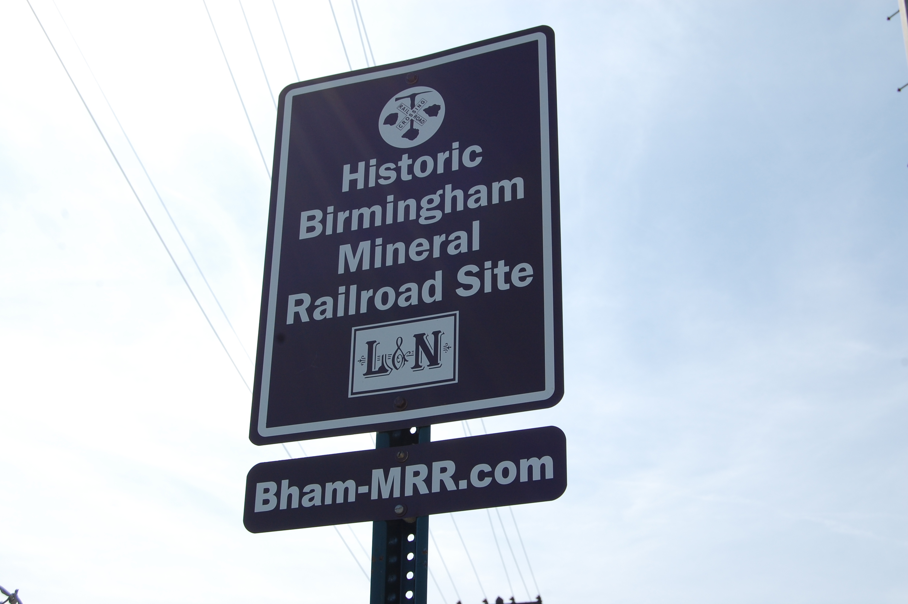
The Historic Birmingham Mineral Railroad Signs Project, a project of the Mid-South Chapter of the Railway & Locomotive Historical Society, is one initiative seeking to bring attention to and preserve what was once a century-long important component of Birmingham’s iron industry: The Birmingham Mineral Railroad (BMRR). The BMRR Signs Project operates off of tax-exempt donations and sign sponsorship. The project was the brainchild of the society’s local chapter president and retired UAB administrator James Lowery, who has worked for three years now to find visible BMRR sites and designate them with an official sign. So far, almost 100 sites have been designated as part of the BMRR trail – AMERICAN Cast Iron Pipe Company was designated number 70.
The BMRR — originally a Louisville and Nashville Railroad Company (L&N) industrial railroad (now CSX) — began with the building of the first branch in 1884 in what is now Red Mountain Park. Additional branches were added and used until they were abandoned at various times, with much of the BMRR going out of service in 1988. Some segments, however, are still in use. The BMRR originally had 31 branches and was 253 miles long. This railroad established the critical linkage between the individual elements of the iron industry, providing transportation between coal mines, ore mines, blast furnaces, rolling mills and foundries.
Some branches of the BMRR also provided passenger services for a time. According to Lowery, the passenger service opened up the outlying communities to the city of Birmingham. “Before, many had to travel by wagon, taking as much as three days, now people could reach the city easily,” he said. “The railroad made the urban city, and the iron industry, possible.”
Lowery took a special interest in the BMRR when he began to discover old, abandoned rail lines in rural areas throughout Birmingham — a neighbors backyard, near his own home, and in English Village.
“I kept making note of the railroad,” Lowery said. “I realized I was seeing it in a lot of places and that if I didn’t know about this part of our history, then others didn’t know either. So, I researched and began the Signs Project in an effort to educate people on these locations they’re walking, driving and biking over daily.”
Using an old map of the BMRR, Lowery and his wife spend some of their free time driving around the area, looking for old branches of the railroad and crossings. Areas with designated signs are chosen based on their public visibility, site importance and high traffic volume. Though the signs designate the locations, the BMRR website is meant to be used as an educational component of the self-guided driving and walking tours. Sign locations, histories, maps and oral histories from locals affected by the BMRR are available on the website.
“People need to understand our heritage,” Lowery said. “For example, the Vulcan Trail on the Southside – that’s an old rail bed. The walking trail below the former Trinity Hospital – that’s an old rail bed.”
The self-guided tours are divided by different areas of the city. AMERICAN is located in the Western & Northern areas of the BMRR, or the Huntsville Branch No. 1 section that includes Bessemer, Hueytown, Fairfield, Ensley, Pratt City and North Birmingham. Other locations on the BMRR tour include the cities of Mountain Brook, Irondale, Oneonta, Trussville and Helena.
Huntsville Branch No. 1 — generally thought to have followed the old pioneer Huntsville Road — began in Bessemer and ran parallel to Interstate 20/59, passing through the cities listed on the tour. It eventually connected to the L&N mainline.
AMERICAN’s BMRR sign is located near the 16th Street Guardhouse gate. The northern-most through tracks (not sidings) between 27th Avenue North and 29th Avenue North are the roadbed of the BMRR, which are the present day CSX Transportation tracks. On old maps, ACIPCO was listed as “a major location and siding” on the BMRR Huntsville Branch No. 1, using the line to transport materials.
“The rail line allowed iron plants to move material quickly and cost effectively — It essentially allowed large blast furnaces to come into existence,” Lowery said. “It was Birmingham’s first major economic development, making the iron industry possible.”
Lowery worked with longtime acquaintance and AMERICAN Engineer Keith Gwin to get the BMRR sign installed near the 16th Street Guardhouse. “I’m very appreciative of Keith’s help and to the company for helping me preserve this important part of the city’s and ACIPCO’s history,” Lowery said.
Learn more about the BMRR online by visiting bham-mrr.com to find information on the self-guided tours, learn more about the BMRR Signs Project and see AMERICAN’s historic involvement. If you would like to make a donation to the BMRR Signs Project or sponsor a sign, visit the “Donations” page located in the right-hand column.
